


If there were a navigation tool that, with the press of a button, could help you find shadier walking routes in Taipei and New Taipei City, avoid waterlogged stretches when it rains, and at night prioritize streets with streetlights, would you want to use it? This August, a map service called Cool Map quickly went viral on Threads. It promotes the idea of “walk two extra minutes, cut your sun exposure in half,” which is especially appealing during hot summers and just as useful when high temperatures continue after autumn begins. The development team says the service’s original goal was simple: to help users find more comfortable walking routes—not just cooler ones, but a smart navigation service that combines time, weather, and environmental conditions.

Taiwan Vampire Map takes you along cooler routes, and it even has rainy day and streetlight modes!
Cool Map was co-developed by three students from the Department of Information Management at National Taiwan University. It began with the question, “If we must walk, can we make the experience a little more comfortable?” Traditional navigation apps usually treat the shortest distance or fastest time as the optimal solution, but for pedestrians, the same five-minute route can feel vastly different under scorching sun versus under the shade of trees. The team therefore believes that the so-called “best route” is not necessarily just the fastest one, but the one that best matches human physical comfort.
【Click here to go to the Taiwan Vampire Map】
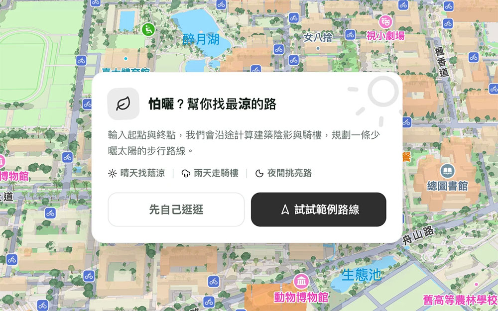
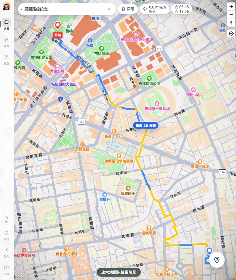
A Spanish research team once presented research results on planning routes based on shade levels, while Switzerland further developed a “vampire mode” in maps that prioritizes guiding users through shaded areas. In Asia, Japan and South Korea have also introduced similar features in recent years, reflecting growing attention to urban heatwave issues. To create a navigation system suited to Taiwan’s characteristics, the team integrated Taipei City 3D building models, street tree distribution, and arcade data to calculate changes in sunlight and shade at different times. In addition to providing the shortest path, it also recommends routes with the best shade coverage, allowing users to choose according to their needs.
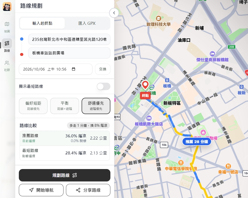
This way of thinking, rooted in local needs, also led to “Rainy Day Mode” and “Night Route Mode.” Given that Taipei is rainy year-round, Rainy Day Mode not only makes use of covered arcade walkways but also incorporates information on flood-prone areas to help users avoid roads where they might have to wade through water. Night Route Mode, meanwhile, starts from a safety perspective and prioritizes routes with denser streetlights. This feature has a lot to do with the fact that team members are women: when walking at night in an unfamiliar environment, people often care not only about speed but even more about whether they can reach their destination safely.

Cool Map has now expanded from Taipei and New Taipei City to the Taichung area, but the biggest challenge in bringing it to the rest of Taiwan is not actually the algorithm—it’s acquiring data. Information on buildings, street trees, arcades, and standing water is scattered across different government agencies, and data formats in each county and city lack unified standards. Some cities even lack complete open data, forcing the team to spend a great deal of time organizing, converting, and integrating it. In addition to people who avoid the sun, those with UV allergies, older adults, children, and dog walkers can all benefit from it. Many people have even begun hoping that a winter sunlight map, an accessible route map, or bicycle-specific navigation will be launched in the future.
Source: KOCPC Chinese