


When making presentations, producing teaching content, or even designing travel information, you often need to use clear and beautiful map materials. Especially for a major tourist country like Japan, it is a popular map search keyword. At this time, I have to introduce this super practical and completely free JapanesemapMaterial website—Map-It (マップ・イット)!
This website is not only for downloadingJapanMaps for the entire region or each prefecture are also provided in two formats: PNG image files and editable EPS vector files, allowing you to freely adjust them according to different needs. Whether you are designing a briefing, making teaching handouts, or using it as a commercial image material, there is no problem at all, and you don’t even need to indicate the source! This article will take you step by step to understand the functions and operation steps of Map-It. Friends who are looking for Japanese map materials must add it to their collection!
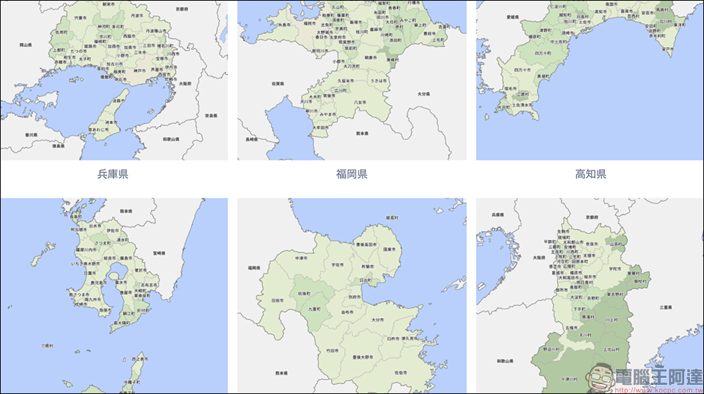
Free downloadable maps of 47 prefectures in Japan, which can be printed, commercially used, and freely modified.
Among the many map download websites, Map-It can be said to be the one with quite complete content and extraordinary content. It focuses on “free downloading of map materials and can be used commercially” and supports various application scenarios such as website design, teaching, and printed matter. It does not require registration, has no restrictions on uses, and does not require attribution of sources. It is a godsend for designers and educators.
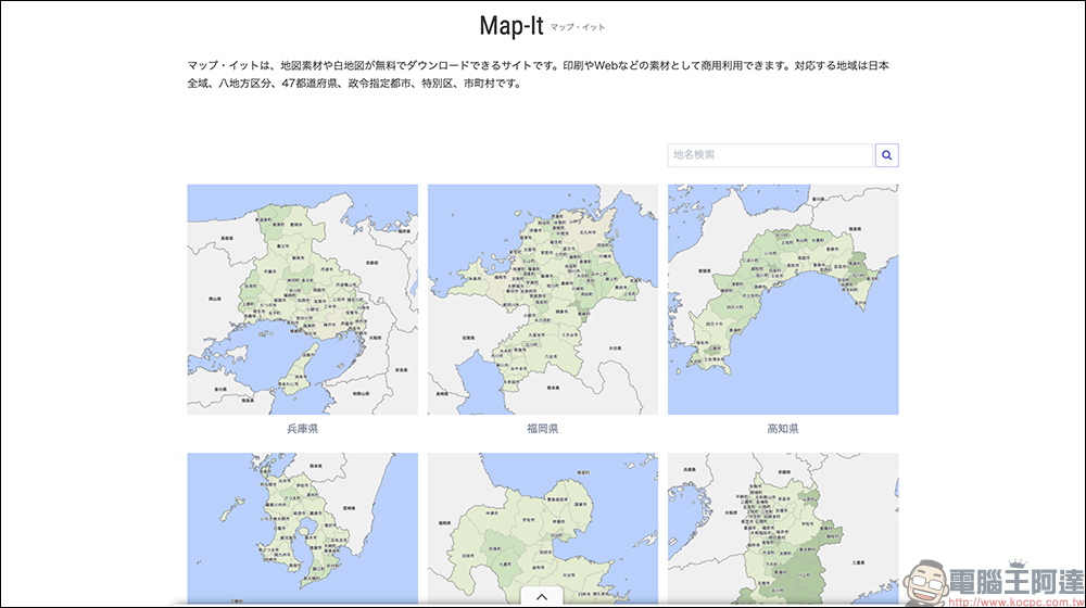
How wide is the supported map range?
Map-It collects a wide variety of maps and has them ready for you from macro to micro, including:
- Japan map
- Eight major regions (Hokkaido, Tohoku, Kanto, Chubu, Kinki, Chugoku, Shikoku, Kyushu)
- 47 prefectures
Cities and special districts designated by various government ordinances - Municipalities, towns, villages and other more detailed administrative units
Simply put, as long as you need a map of Japan, no matter how detailed the level or how small the division, you can almost find it on Map-It.
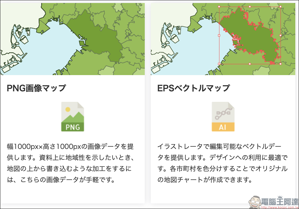
Two map formats are provided: PNG file & EPS vector map
- PNG image file (1000×1000 pixels):
It is suitable for quick use and does not require much editing, such as placing it in a presentation or marking a general area. This format can be directly downloaded and used, which is highly convenient. - EPS vector diagram:
Suitable for further design, color matching, marking or adding your own style. It can be edited using Adobe Illustrator, and each administrative block can be colored individually, making it suitable for making your own exclusive map.
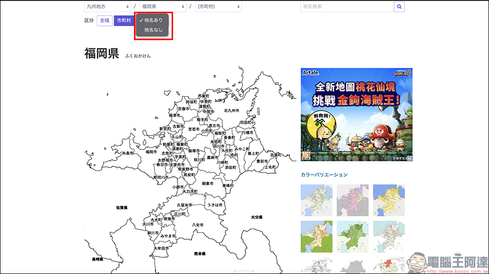
Before downloading the map, users can switch the map color style (such as Wikipedia style, MapFan color matching, etc.) according to their needs to make the map visually more consistent with the theme you design. Another practical little function is: place name display switch. If you want the map to be clean without place names, you can just turn it off with one click, and the screen will become very suitable for you to add labels or descriptions yourself.
Operational teaching (super simple 4 steps)
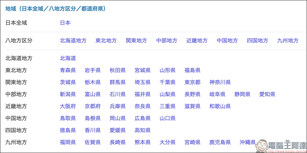
1. Select the map level:
Enter Map-It official websiteThen, select the map category you need, such as “Full Map of Japan”, “Eight Major Regions”, “Each Prefecture”, etc.
2. Preview map & select color:
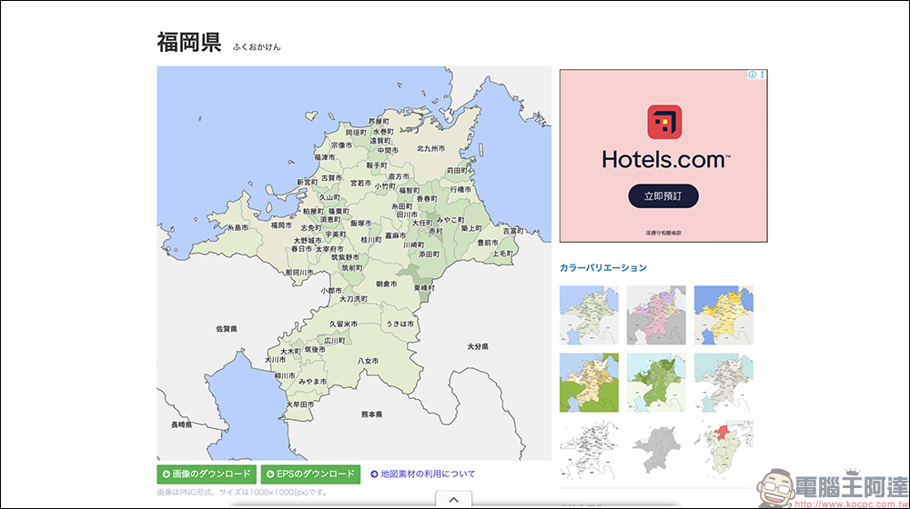
After clicking on a region, a map preview will be displayed, with brief information and Wikipedia links below. You can switch between different colors in the upper right corner to make the entire picture more consistent with the style you want to present.
3. Whether to display place names (optional):
There will be a toggle button above the map to control whether the map displays place names. It is displayed by default, but if you prefer a clean screen, you can easily turn it off.
4. Click the download button:
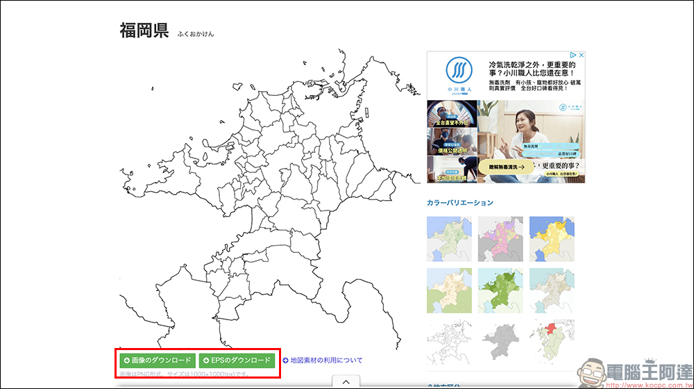
There will be two green buttons below the map: one to download PNG and the other to download EPS. Choose the format that suits your needs.
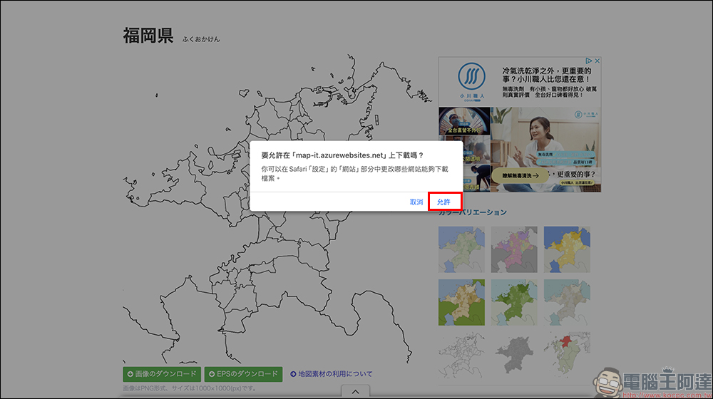
Click to download:
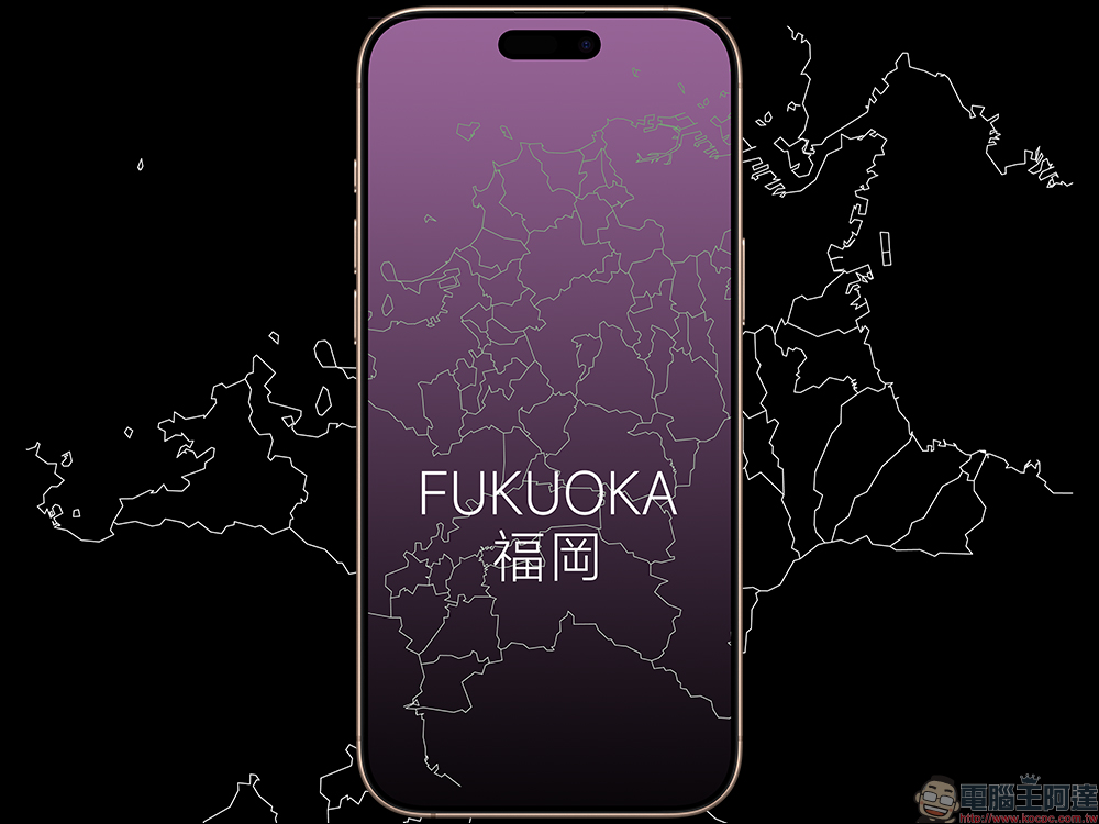
There is no need to indicate the source, but you can put a website link to support the creator. Although Map-It allows free use of map materials, whether it is for personal or commercial use, it is no problem. For example, you can easily make an iPhone wallpaper with your own design and creativity. The website also says that they would be very grateful if you would put a hyperlink back to their homepage. This is also the most basic support for free resource websites!
Conclusion
Even if you are not someone who uses maps every day, having this free, license-free, and commercially available Japanese map material library in your pocket list may come in handy one day. Especially for people who often make reports, create course content, or design travel materials, the convenience provided by Map-It cannot be underestimated. It is recommended that you bookmark this website so that you can open it and use it immediately if necessary. After all, free is the best, and it’s so easy to use, which is really rare!
Map-It Japan map download:
https://map-it.azurewebsites.net/
Further reading:
Source: KOCPC Chinese