


For friends who often use Google Maps to plan journey navigation, although the map service itself provides options to avoid toll roads. But sometimes you really want to consider the approximate price difference between toll highways and alternative roads before making a decision. But it is a pity that such a function has not been possible before (although other navigations have it). But now it seems that Google is ready to bring functions similar to public transportation price estimates to driving information, and has also provided relevant updates to iOS (Sahua). Continue reading Google Maps update significantly adds navigation information, even tolls can be helped to calculate the content of the report.
▲Photo source of this article: Google
Google Maps update significantly adds navigation information, even tolls can be helped
Every time I see paid/free route options listed on Google Maps, I wonder how big the “price difference” between the two routes is? This thoughtful estimation function is available in many navigation software, and Google has officially announced on its blog that it will be supplemented by its own map function – don’t be surprised, this function is initially launched in limited countries and regions, and Taiwan is not included in the scope (I tested it and have not yet received it).
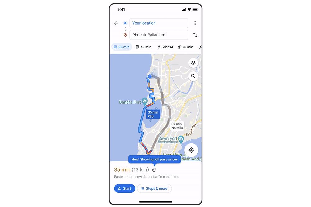
Although many functions have been launched in Taiwan before (motorcycle navigation is awesome!), this wave will start with the United States, Japan, Indonesia, and India this month. However, the official also mentioned that more countries will be launched “Coming soon”, so you can still expect Taiwan to suddenly appear in the navigation planning information of Android and iOS.
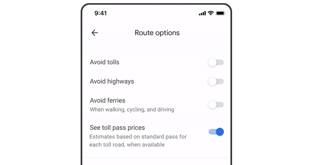
That is to say, if you don’t want to see the price, you can find the new “See toll pass prices” in the “Route Options” under “…” in the navigation interface and uncheck it – I’m curious, is there anyone who really doesn’t want to see this information?
When the function goes online, you will also see a shortcut to change this setting directly in the detailed information in the navigation drawer interface.
In this wave of updates, Google also announced that for Android, iOS and even corresponding car platforms such as Android Auto and CarPlay, it will begin to introduce the display function of traffic lights and “Stop” signs that must be paused before opening intersections during navigation. It will also strengthen the range marking of points of interest; in specific cities, you can even see road shapes and even separator island markings.
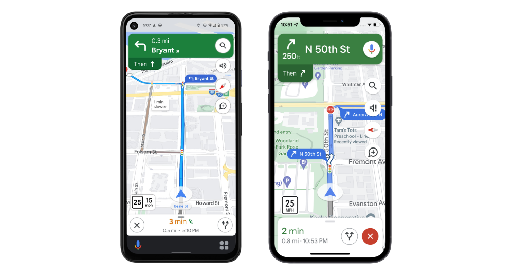
Although the imported information may not allow you to instantly know whether the next intersection is a red light or clear (it feels like it is not impossible to add it), it can at least give the driver the opportunity to more easily identify the intersection position he is in, instead of relying entirely on the GPS positioning display that occasionally drifts. I wonder if everyone has begun to notice these changes?
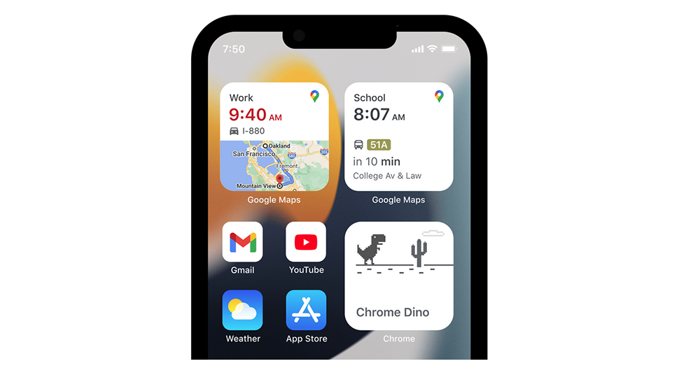
That is to say, for those who are deeply involved in the iPhone ecosystem or even use Google Maps with Apple Watch, it should not be difficult to find the new changes in this update. Widgets including iOS and watchOS, and even the “shortcut” function have been improved. You can add it to the desktop to see what changes there are.
Further reading:

Source: KOCPC Chinese