


The epidemic in Taiwan has been escalating very rapidly in recent days. Although the Central Epidemic Command Center publishes the footprints of confirmed cases every day, after all, it is only text, and there are so many people that it is actually somewhat difficult to check. For this reason, enthusiastic netizens have created an unofficial version of the “Footprints of Diagnosed Persons” map for everyone’s convenience.
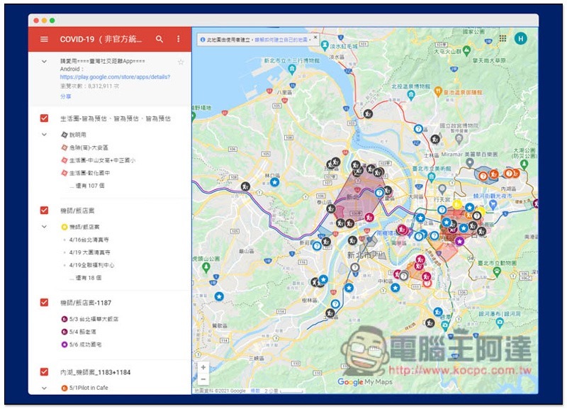
Enthusiastic netizens create “unofficial Google Maps of the footprints of confirmed cases”
This unofficial version of Google Maps for confirmed cases not only includes the recently announced activity footprints of confirmed cases, but also consolidates disinfected locations where news about confirmed cases has been reported, as well as the affected living circles.
After entering this map, there are human-shaped icons showing the places where confirmed cases have been, and there are also simple text descriptions on the left, including the estimated living area and the visit date of each confirmed case:
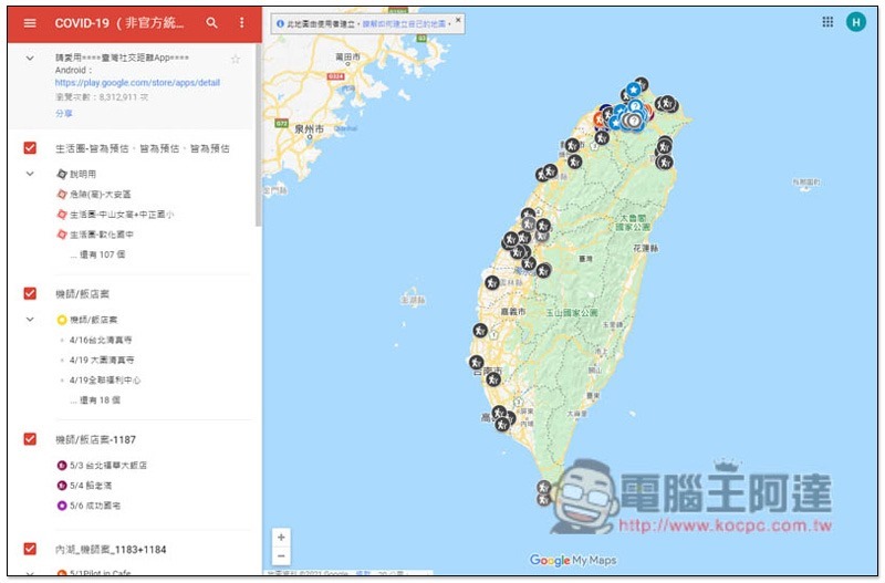
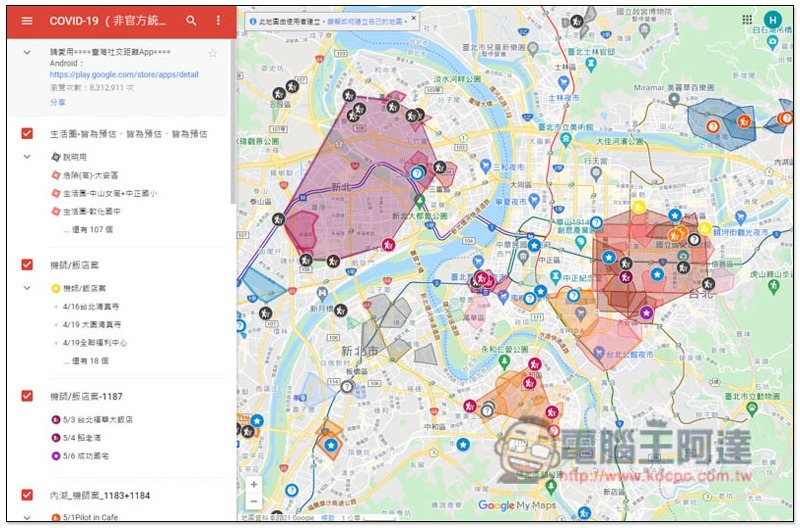
After zooming in on your living circle, you can view more information. Taking Taipei City and New Taipei City as examples, in addition to human-shaped icons, you can also see icons such as question marks and stars. These icons represent different epidemic information. For example, the question mark indicates where family members who have been diagnosed work, and there are also areas divided by colors:
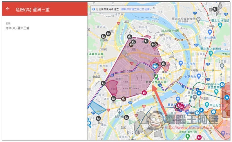
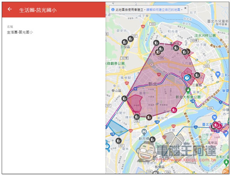
For example, if I click on the Luzhou Sanchong square, a reminder will appear on the left that it is a high-risk area. However, this is only an estimate, and does not actually mean that the area inside the colored square is very dangerous. The general idea is to be more vigilant:
Some colored squares refer to the living circle of confirmed cases:
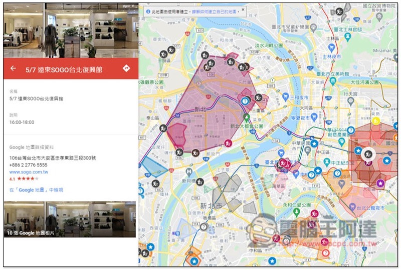
Clicking on the left side of any icon will display relevant information, as shown below on 5/7 Far East SOGO Taipei Renaissance Hall, the time is 16:00~18:00:
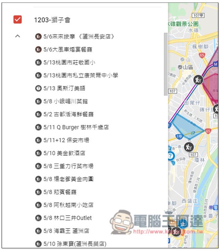
You can also view the footprints of each confirmed case directly from the left column:
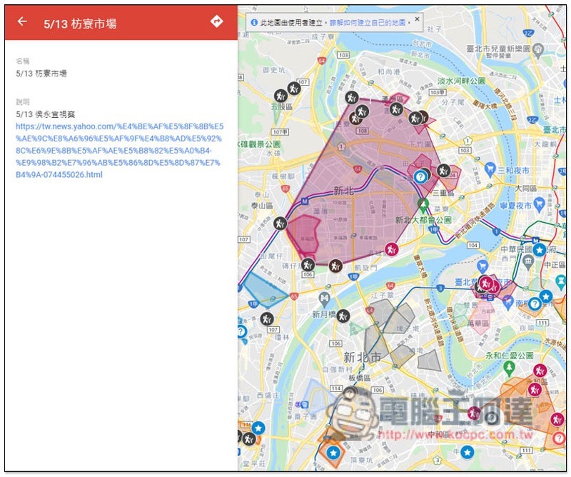
Non-human icons will provide news link references:
I would also like to remind you that this map is an unofficial version after all, and the update speed will not be that fast. The producer also recommends installing the command center “Taiwan social distance“App, the comparison will be more accurate, and if you accidentally come into contact with a confirmed person, you will be notified immediately.
For those who are unclear about their route in the past few days, if you have downloaded Google Maps on your mobile phone, you can try to check it through the built-in timeline function. After clicking on your profile picture, you can find the “Your Timeline” function, and then you can browse your daily footsteps.
Source: KOCPC Chinese