


When traveling, some people may want to document all the places they’ve visited as a keepsake, and even consider printing them out to hang on the wall. This article recommends “MapToPoster JS,” a free online tool that lets you easily create high-quality map posters, offering a variety of templates and sizes, along with the ability to add pins, routes, and text to the map.
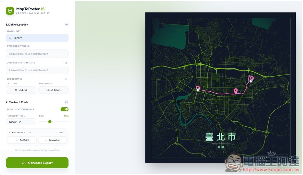
MapToPoster JS – A Free Tool for One-Click Generation of High-Quality Custom Route Map Posters
MapToPoster JS is a powerful open-source online tool designed for map art enthusiasts and designers, developed by full-stack developer Dimar Tarmizi.
This application, dubbed the “Procedural Map Artist,” can perfectly transform any location on Earth into a high-resolution, high-quality customized map poster. Unlike many drawing tools that rely on server-side computation, MapToPoster JS’s biggest highlight is that it’s a 100% client-side web application, meaning all your operations, location search, and high-quality image rendering happen instantly in your browser—not only protecting your privacy but also delivering an exceptionally smooth real-time preview experience.
Seamlessly blending a hybrid rendering system to merge standard grid maps (like minimalist white or dark mode) with procedural vector art styles (such as Cyber Noir tech aesthetic, Golden Era vintage flair), you can simply input coordinates or a city name, then use the interface to configure layouts, typography (with support for multiple sans-serif and serif fonts), and even add gallery-quality frame border effects to effortlessly create professional-grade visual artwork.
Whether you want to create a minimalist wall art piece for your home or turn your travel journey into a phone wallpaper, it can handle it all.
Main Features
- Supports searching directly by city name, or entering precise latitude and longitude coordinates to target specific areas
- Features built-in Standard (Standard Street View/Satellite) and Artistic (Artistic Vector) theme categories, with customizable color codes for various roads and water areas.
- Place landmark markers on the map and draw or fine-tune travel routes from point A to point B
- Adjust perspective zoom, apply vignette filter, and freely customize the typography of city and coordinates
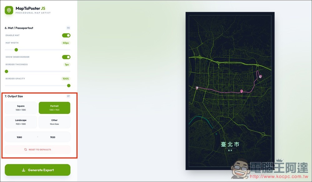
- Built-in presets for over 30 high-resolution sizes including social media (IG, FB), wallpapers (4K, mobile), and print materials (A0~A5 posters)
After clicking the link above to access MapToPoster JS, you’ll see the map poster on the right side and the control interface on the left. If you can’t read English, you can use your browser’s full-page translation feature to translate it to Chinese:
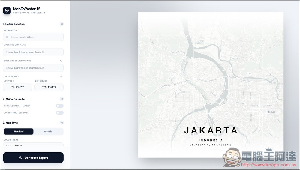
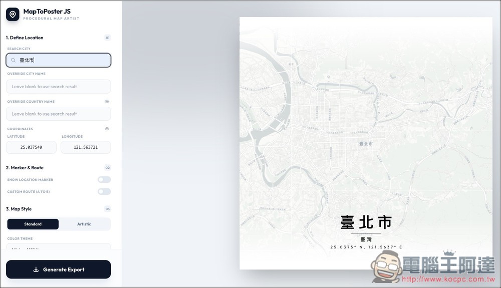
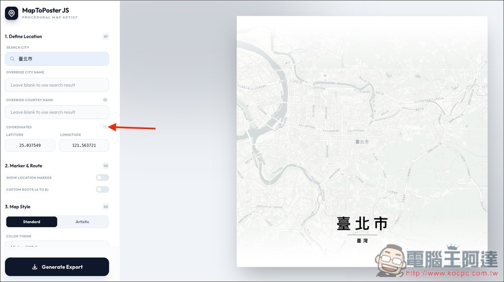
On the left side, under SEARCH CITY, enter the name of the city you want to display. It supports Chinese. I entered Taipei City:
If you want the map to display a different name, you can change it below.
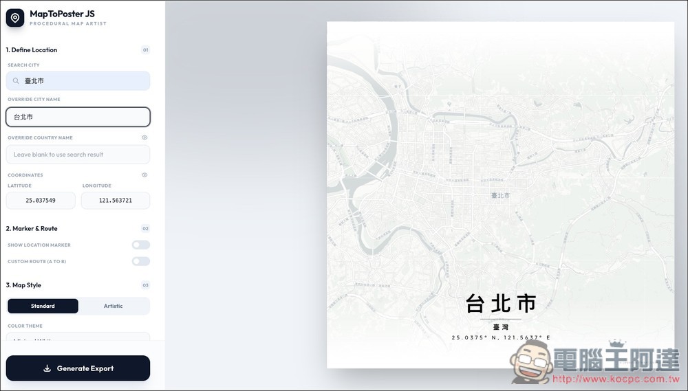
If you don’t want to display the coordinates, just turn off the eye icon for COORDINATES.
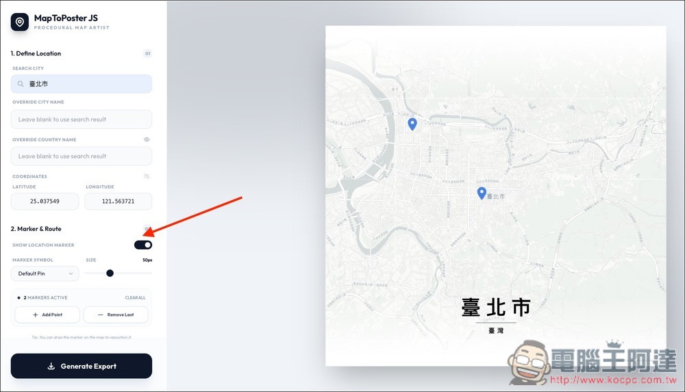
Marker & Route is the feature for adding pins and routes. There is no limit on the number of pins—you can add as many as you want, and the size can also be adjusted:
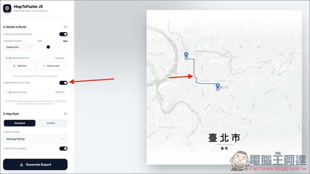
As for the route, there’s only one path from A to B. You can freely place points A and B anywhere, and the route will be drawn automatically. Of course, you can also adjust it to a different route.
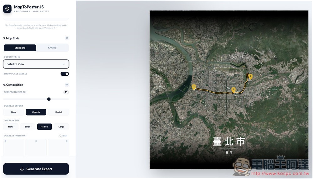
Map Style is a map style. Standard offers Classic Street, Midnight Dark, Minimal White, Modern Voyager, and Satellite View for a total of five:
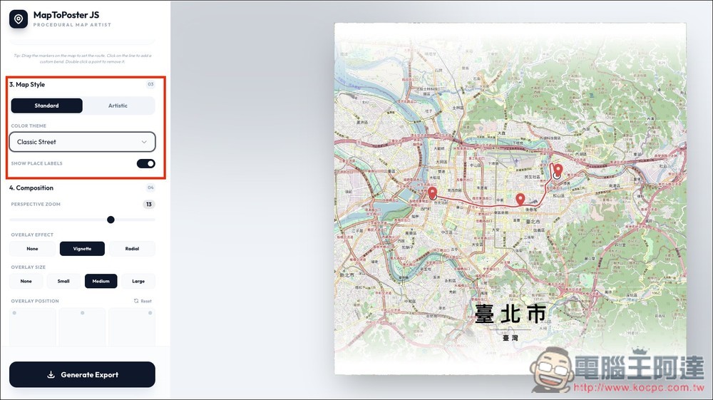
Satellite view isn’t bad either:
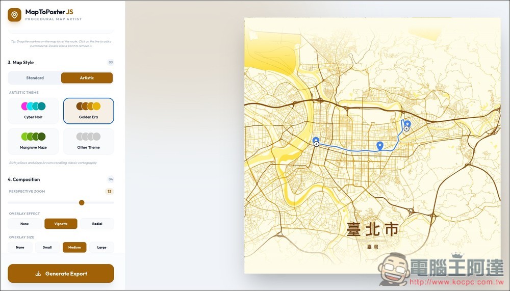
Artistic is an art style with multiple color scheme options:
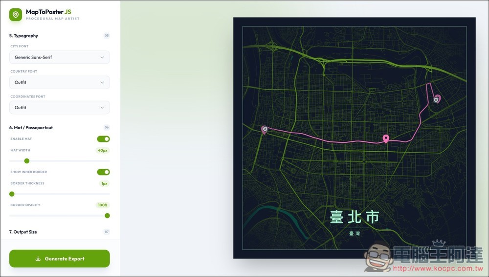
The font can also be modified, or even given an outline.
There are plenty of size options to choose from. Once you’re satisfied, click “Generate Export” below, and the map poster image will be downloaded.
Source: KOCPC Chinese