


Although Google Maps also provides offline map functions, there are still some restrictions on its use. For example, offline navigation can only be used for driving, and other modes are not supported. For people who are very concerned about privacy, they may also worry about whether their data will be collected when using it. CoMaps to be introduced in this article is different. It is a free open source map app that focuses on protecting user privacy. It was developed with offline experience as the top priority. It means that you can use all functions offline, including checking locations, all navigation modes (even voice playback), querying added favorite locations, etc., both iOS and Android versions are available.
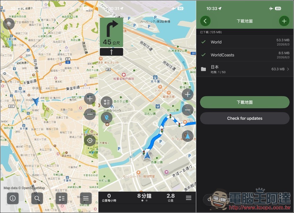
CoMaps introduction and operation tutorial
CoMaps is a free and open source navigation tool maintained by the community and based on OpenStreetMap data. It focuses on offline, privacy and non-profit. Users can download the complete map in advance. Even if they go abroad without mobile network or enter mountainous areas with poor reception, they can still search for places, plan routes, and use voice prompts to navigate on foot, by bicycle, or by car.
In addition to including a large number of locations such as restaurants, hotels, gas stations, shops and attractions, it also provides an outdoor display mode that can mark hiking routes, campsites, water sources, peaks, contours, walking trails and bicycle paths. When you see places of interest during your trip, you can even bookmark them with one click and sync your bookmarks and movement tracks through iCloud. It also supports offline reading of Wikipedia content, making it easy to understand attraction information when there is no Internet.
For those who climb mountains, bike, or like to record journeys, CoMaps can record GPS tracks and import or export them in KML, KMZ, and GPX formats, making it easy to organize, back up, or share them later. The built-in OpenStreetMap simple editor allows users to supplement or modify location data and contribute their findings to the community. In addition, the app supports CarPlay and dark mode.
Privacy is also the biggest feature of CoMaps. The development team stated that the App does not identify users, does not track activities, does not collect personal information, and does not display advertisements; the App Store privacy label also shows “Do not collect data.” Streamlining maps also helps save storage space and battery on your phone. However, it does not have as large a cloud ecosystem as large commercial maps, so the completeness of the map will be affected by the quality of OpenStreetMap local data.
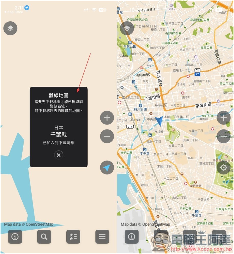
CoMaps has many functions. Here are a few commonly used ones. When you open CoMaps for the first time, it will automatically download the offline map of your current area:
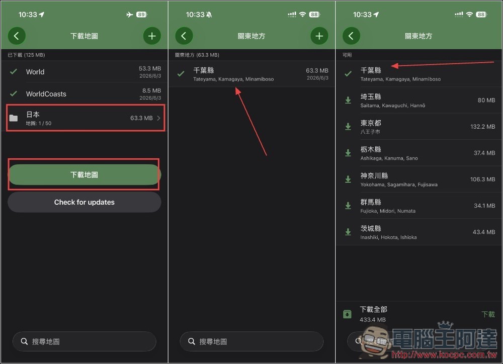
If you want to download maps for more countries and regions, you can go to the download map option in the settings and specify it here. I am currently in Chiba Prefecture, so the App only downloads Chiba Prefecture, and does not download the maps of other Kanto places:
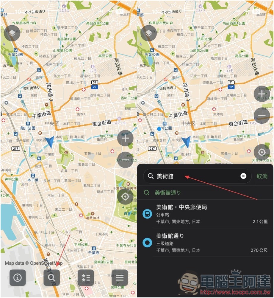
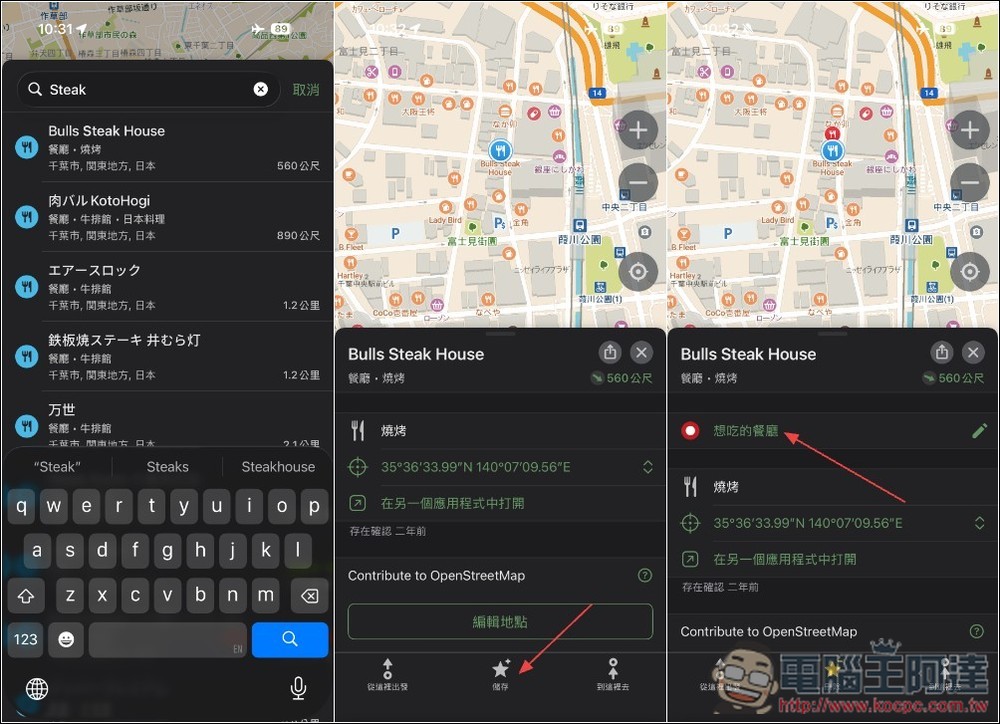
Supports search function, enter keywords to find matching results nearby:
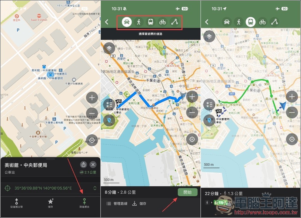
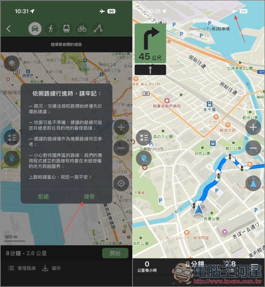
I turned my phone into airplane mode and turned off WiFi. In actual testing, it can indeed be used offline. The same goes for the navigation part. Even if there is no Internet, you can still use navigation modes such as driving, walking, public transportation, and bicycles:
Voice announcements are also supported during navigation:
You can add your favorite places to the list for quick review in the future:
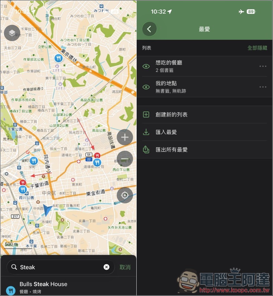
Places that have been added to the list will also be highlighted on the map:
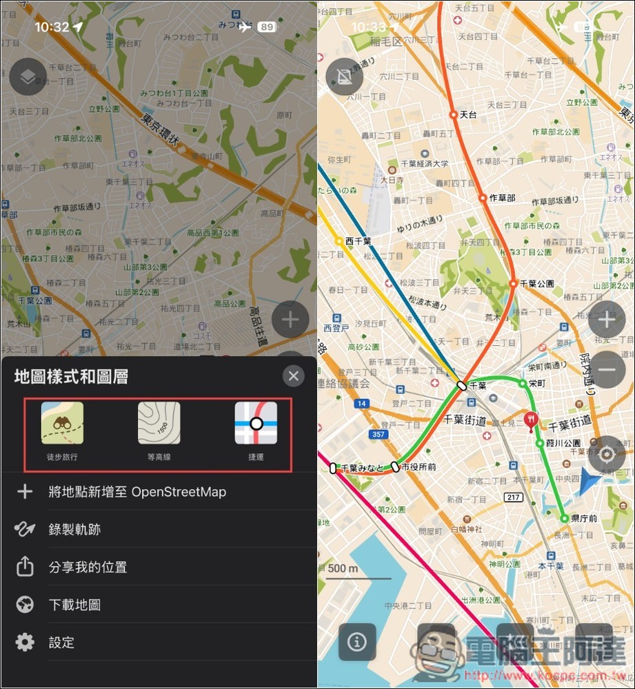
Map styles and layers can also be changed, currently three are provided: Hiking, Contour and MRT:
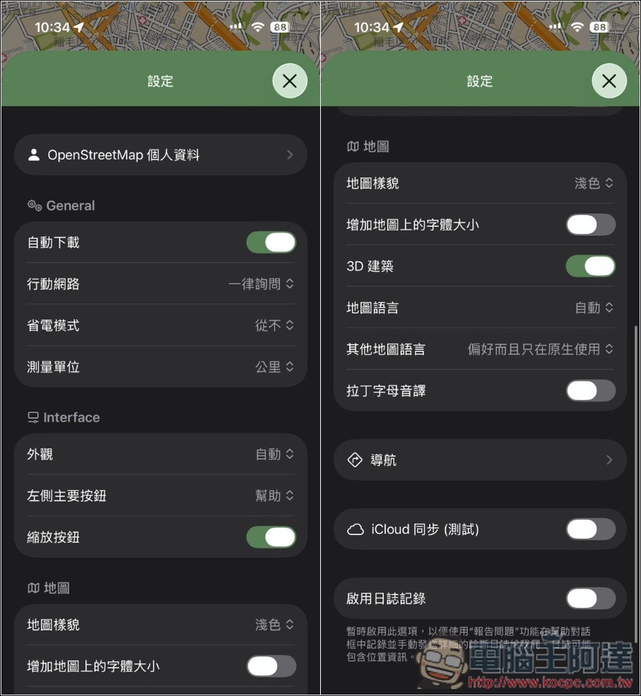
In the settings menu, there are many items that can be adjusted:
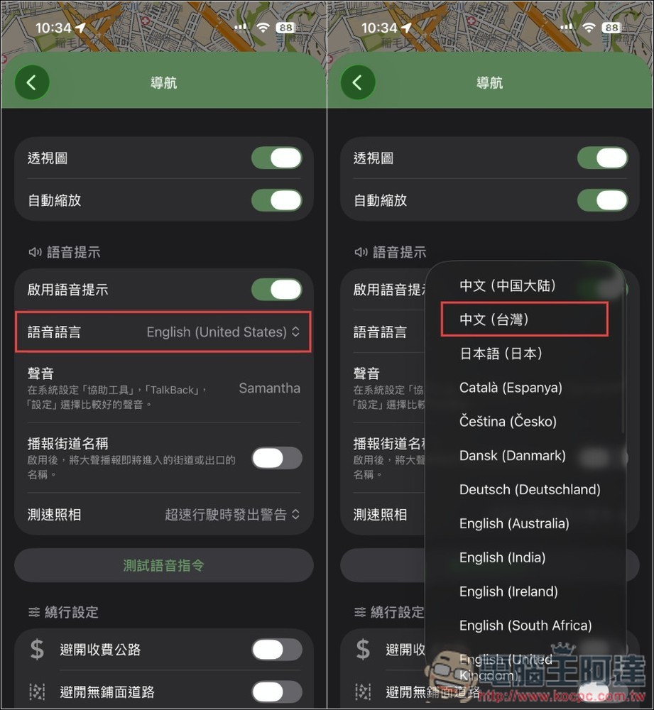
For example, the voice language can be changed to Chinese:
Source: KOCPC Chinese